
PRo3D-GIS: Austrian analysis tool for ESA’s Hera mission
PRo3D already has a long history in planetary research. The tool has evolved across several generations of research projects and space missions and has been used in the context of NASA Mars 2020 and ESA ExoMars, among others. Within NASA Mars 2020, PRo3D was used to examine and geologically interpret 3D reconstructions of the Martian surface.
In 2021, VRVis and JOANNEUM RESEARCH also used imagery from the Perseverance rover to prepare a 3D reconstruction of its immediate landing area in Jezero Crater and present it as a virtual flyover.
From PRo3D to PRo3D-GIS
For ESA's Hera mission, PRo3D has now been specifically extended. Hera is on its way to the binary asteroid system Didymos/Dimorphos, where the spacecraft will investigate the effects of NASA's deliberate DART impact on Dimorphos. DART changed the asteroid's orbit in 2022. Hera will study the outcome in detail and help scientists better understand kinetic impact as a method of planetary defense. Hera is scheduled to arrive at Didymos in November 2026.
For the scientific analysis of Hera data, PRo3D has been expanded into the mission-specific PRo3D-GIS. While PRo3D was originally focused primarily on the analysis of planetary surfaces, Hera requires data from different instruments and mission phases to be examined in relation to one another. PRo3D-GIS therefore brings together surface models, imagery from different instruments, the spacecraft's position and trajectory, and other mission data in a shared spatial and temporal context.
Sensor imagery can be projected directly onto the reconstructed surfaces. This allows researchers to determine which part of an image corresponds to a specific location on a celestial body, compare observations from different instruments, and analyze data directly in its spatial context. This is one of the key developments from PRo3D to PRo3D-GIS: a tool for analyzing individual planetary surfaces has evolved into a shared 3D environment for multiple types of scientific mission data.
The functions developed for Hera have already been tested with real mission data ahead of the spacecraft's arrival at Didymos. This included data from Earth-Moon observations in October 2024 and from the Mars flyby in March 2025. These mission phases made it possible to test instrument-data processing, the visualization of Hera's trajectory, and new PRo3D-GIS functions under real
mission conditions.
Preparing for Hera’s arrival at Didymos
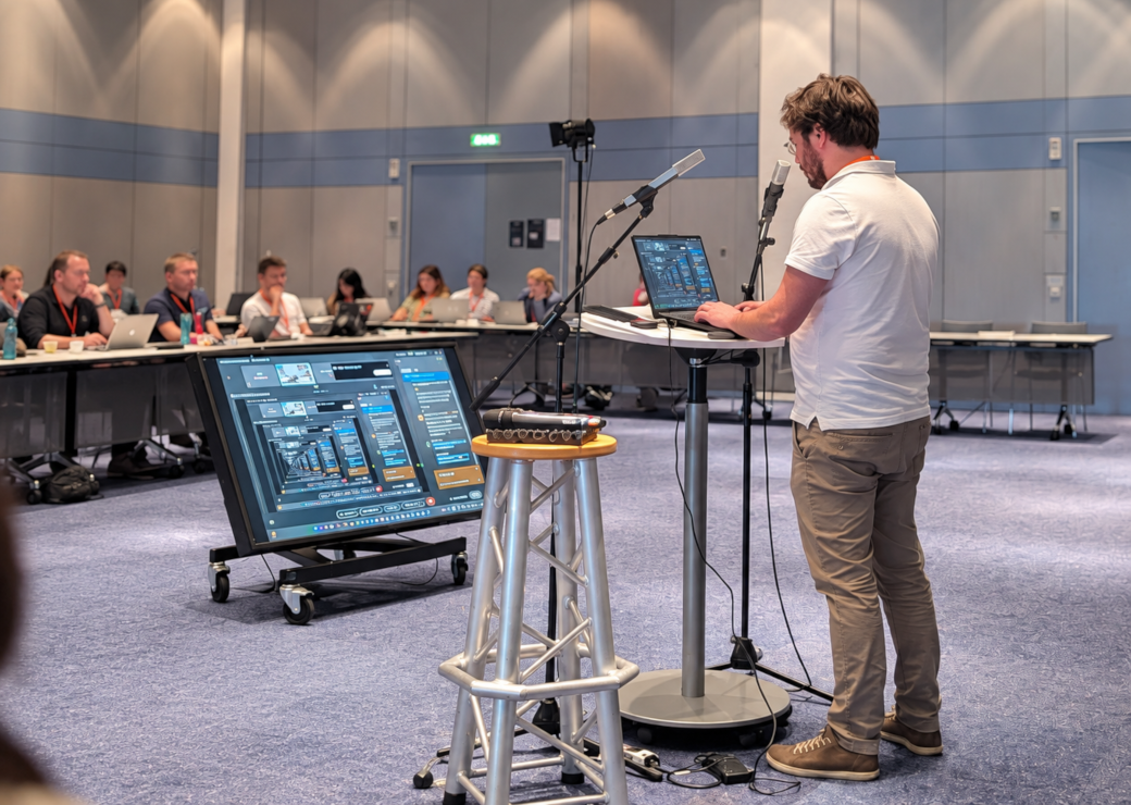
At the end of September, VRVis researchers Harald Steinlechner and Sophie Pichler are at ESA's European Space Operations Centre, ESOC, in Darmstadt. During a Hera workshop, they are training
mission participants to work with PRo3D-GIS. They will then take part in end-to-end testing of scientific mission data products.
The development of PRo3D is based on a long-standing Austrian research collaboration between VRVis and JOANNEUM RESEARCH. JOANNEUM RESEARCH contributes particular expertise in 3D reconstruction and planetary remote sensing, while VRVis continues to develop PRo3D's interactive visualization and scientific analysis capabilities.With Hera, this development is entering a new phase: from virtual geological fieldwork on Mars to
the analysis of a dynamic asteroid system involving multiple instruments and data sources. When Hera reaches Didymos and Dimorphos in November 2026, PRo3D-GIS is intended to help scientists bring the newly arriving data together spatially, relate different observations to one another, and analyze them.
Funding
The project is financed through the Austrian contribution of the Federal Ministry for Innovation,
Mobility and Infrastructure (BMIMI) to ESA's Space Safety programme. VRVis GmbH is funded within the framework of COMET – Competence Centers for Excellent Technologies (911654) by BMIMI, BMWET, the State of Tyrol, the State of Vorarlberg and the Vienna Business Agency. The COMET
programme is managed by FFG.