Data Patchwork, Geodata Cubes and the "Starbucks Effect

Be it for the selection of new locations for beverage vending machines, the planning of offline marketing campaigns or the evaluation of real estate prices: in order to be able to make well-founded decisions, the most up-to-date and detailed maps possible of demographic and economic indicators (such as average age, household income or day/night population) are required.
The problem is that maps from the data sources currently in use in the sector usually do not meet the requirements of their users: they are often not sufficiently up-to-date, are only recorded in coarse administrative units (e.g., district or municipality), are hardly comparable across national borders or - especially in developing and emerging countries - are not even available in the first place. In short: a global "data patchwork".
ubicube, an Austrian high-tech startup founded in Graz in May 2021, aims to solve this problem with a completely new approach. In addition to their existing portfolio of earth monitoring services, the ubicube team is working on an online data warehouse for demographic and economic data and maps. The special feature here is the spatial and temporal flexibility of the data. Users can order the desired indicators for any area and time, in different levels of detail and independent of administrative boundaries.
Success with Copernicus
This innovation is made possible by an in-house developed geospatial intelligence software, which is able to understand spatial patterns, to describe them on the basis of existing geodata and finally to transfer them to arbitrary geographical areas. Copernicus satellite images (Sentinel 1,2 and 3) and points-of-interest data (POIs) are collected from a variety of sources, transformed into relevant information using state-of-the-art methods from the fields of remote sensing, computer vision and data mining, and finally stored in so-called geodata cubes. These geodata cubes are then accessed by state-of-the-art machine learning algorithms to find correlations between the extracted geoinformation and the actual expression of a demographic or economic indicator. According to Andreas Salentinig, founder of ubicube, this concept is best explained by the "Starbucks effect": "It has been proven that the locations of Starbucks coffee shops are directly related to local rental prices for commercial and residential properties. The closer a property is to one of these stores, the higher the rent.
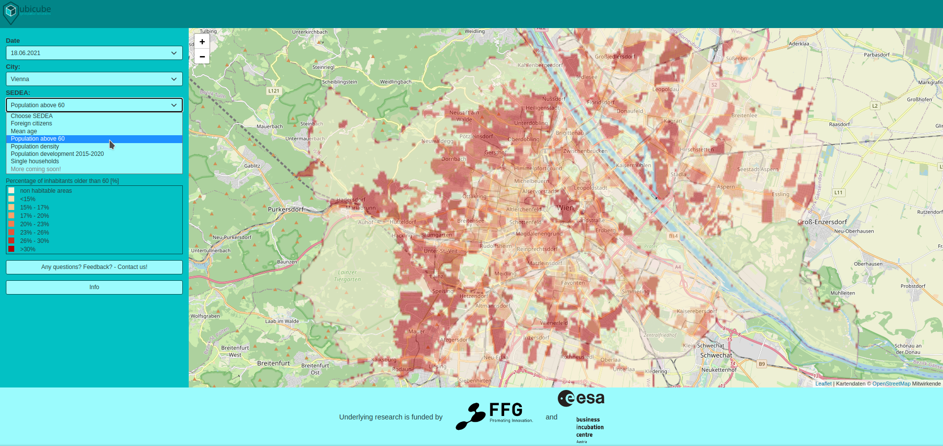
ubicube's geospatial intelligence looks for precisely such correlations and makes use of what is probably the greatest strength of machine learning: recognizing patterns in huge amounts of data that go beyond human perception." In ubicube's solution, the added value of POI data and especially satellite imagery data becomes particularly apparent, as it is the only way to make the service globally scalable. In a research project financed by the Ministry of Climate Action (BMK), funded by FFG and ESA BIC, the ubicube team is trying to find out for which demographic and economic indicators geospatial intelligence works particularly well. In this context, an online showroom was recently launched, providing a first impression of the user experience and functionalities of the planned data warehouse: https://sedea.ubicube.eu/." With our service, we enable access to demographic and economic data in an unprecedented way: simple, flexible and scalable. However, we also know that there is still a lot of potential in our solution and are already working on new use cases for our geospatial intelligence," says Salentinig.